Don’t be a rope-a-dope

In the whole scheme of boating one of the least expensive items you’ll buy for your boat is a set of dock lines. You’ll handle the lines every time you go boating. So why do so many boaters refuse to spend a few bucks?
At my marina you’ll see lines of different sizes and colors, some with eye splices and some with knots and I’m talking about the same boat. One of the signs of an amateur boater, in addition to cruising around with all your fenders hanging, is wrapping the excess line around the dock cleat 35 times rather than making a neat Flemish flake or a slip chain. Lastly, don’t be a rope-a-dope. There are no ropes on a boat. As soon as a rope goes on the boat or is tied to it, it’s a line.
The test of a good knot is can it be untied easily. Recently a boat in my marina was moving and the owner had his detailer, Jose, helping him move. Jose spent half an hour to untie the line from the piling. This negated the savings of not buying a line with an eye. Three strand nylon with a prespliced eye is only a few dollars more. A knot can reduce the strength of a line up to 50%. A splice can retain about 90% of the tensile strength.
Since I’m spending your money, how much are we talking about? A 25’ three strand economy 1/2” line costs $19.99. A premium line cost $32.99 and is 30% stronger. Double braid is stronger yet and is $38.99. (West Marine online prices) All the prices were different in my 2012 catalogue and will probably be higher when you read this article. Welcome to boating. To save a few dollars, dock lines are a good thing to buy at a marine flea market.
White lines are stronger. But, colors look better. For ease of handling double braid is the way to go. I like to have different colors for different lengths. The general rule for length is 2/3 of the boat length for bow and stern lines and the boat length for a spring line. Your permanent dock lines could be sized to your dock so you may save a few dollars.
Speaking of spring lines, if you dock in a slip you probably only need a forward spring line to keep from going back into the seawall. At my marina several boats have forward and after spring lines and breast lines. Maybe they’re expecting a hurricane. When you tie up alongside a pier in a crowded marina you can use a forward and after spring line as you may have a boat in front and back of yours.

By Bob E. Sherman
Syndicated Writer with Florida By Water
http://www.bobesherman.com/

Baby It’s Cold Outside

The months of January, February and even part of March are not known as the best months for boating here in North Florida. In fact, many us tend to focus our attention on other things and try to patiently wait out the less than ideal conditions. However, as a passionate boater I find these down times to be a blessing in disguise. As with any lifestyle, it’s imperative to set aside time for planning and education. I know that this doesn’t necessarily sound exciting, but you’ll have to trust me – it is!

The Perfect Destination
If I’m not going somewhere on my boat, the odds are I’m planning my next adventure. I’ve come to realize that thinking about and planning a trip to a tropical paradise can be almost as rewarding as the actual trip itself — and honestly sometimes better. In my mind the weather is always perfect, my boat never breaks down and the seas are always calm. Therefore I find myself spending the winter months either planning my summer trips or daydreaming about warmer days and tropical destinations.

Your first stop in planning a cruise is often the internet, but the information you’re hunting for is often hidden and difficult to find. That’s why I created Florida By Water — to save you the endless hours I spent searching for new destinations to explore by boat. The site is broken down by city and then into categories like campgrounds, marinas, daytrips, restaurants, boat ramps and hotels. Often you’ll find reviews from other boaters that can help you make your decision. Every location on the site is accessible by water. Florida By Water does not charge for listings, therefore we list anywhere and everywhere you can get to on your boat.

My recommendation: look for areas you’ve never visited before. Last summer we discovered Carrabelle, Florida. It’s one of those small but great boating and fishing destinations that tend to be overlooked by the majority of boaters. Carabelle’s a quaint town with great water access and the charm that only a small fishing village can bring. Here’s another example a Florida By Water member sent me a few weeks ago:

“We are still cruising. We are at Whiddens Marina on Gasparilla Island, a charming, hospitable, old Florida marina that has been in the same family since the twenties. Another one of those hard to find spots only locals know about. This place has character. A highlight of our journey! When I asked the lady how much to stay the night she said she gets $40. When we said we would anchor in the harbor for the night she said to just stay on the dock for free as there is no one else here staying. I believe she lives in the upstairs of this old building. There is an old (everything here is old) museum attached and an outhouse with shower. It's wild. Like we have gone back in time. While it may not appeal to all, we feel privileged to find and be able to experience the rustic nature of this place. We will be back home on Tuesday.”

Once I’ve chosen my destination, I spend the next few weeks charting my waypoints. Personally I use Garmin Homeport for my charting software, however many companies make the same type of software. I can easily add all of the GPS coordinates from the comfort of my home, create routes and upload them to the chart plotter. Then I’ll save these and revisit them many times before heading to my new location. Another great information source — a quick call to a local sea tow or marina can provide valuable tips about the area. Just make sure that when you’re boating in unfamiliar waters you always use your charts, as well as local information.

Events
Another winter option is to attend some of the many boat shows that are held after the first of the year. More than half of the NMMA boats shows are held during the month of January. Here in the Jacksonville area, the Jacksonville Marine Association Boat Show is at the Prime Osborne Convention Center from January 27-29, and the Southeastern Boat Show’s at Metropolitan Park April 20-22. If you’re up for a road trip, one of the best boat shows in the nation is in Miami on February 16-20. You can find a complete list of boating events at http://www.floridabywater.com/events

Whatever you decide to do, you’ll find you don’t have to completely break from boating just because the weather is a little less than desirable.

Rusty Gardner is the owner and President of floridabywater.com & Boatflorida.com

Florida By Water is recognized for outstanding tourism marketing in Florida

Florida By Water is pleased to announce that we have been awarded the Flagler Award for “Best in Show” (under $100K category) from VISIT FLORIDA. The Award was presented during the 44th Annual Florida Governor’s Conference on Tourism, held September 25-27 at the Westin Diplomat Resort & Spa in Hollywood, Florida.


Named for Henry Flagler, the Flagler Awards were established in 2000 to recognize outstanding tourism marketing in Florida. Annually, the Flagler Awards honor many of the countless individuals and organizations that help maintain and improve Florida’s position as one of the world’s most popular travel destinations. The awards are open to all individuals, private businesses and not-for-profit organizations offering a product or service that promotes tourism to or within the state of Florida.

Simply Carrabelle

Carrabelle River
Carrabelle River

There are few places in Florida where you can experience solitude on an abandoned beach while watching the sun set over the Gulf. However, a small town on the Forgotten Coast is just the place if you're looking to get away from the crowds, traffic and endless displays of Florida t-shirts. Carrabelle is located about an hour south of Tallahassee, along Highway 98. Recently we decided to take a look for ourselves and see if this small fishing village had anything to offer. With the boat in tow, we made the 4-hour trip from Jacksonville with no preconceived notions.
Carrabelle is not exactly forgotten, it's just not talked about much. (Its claim to fame is the world's smallest police station.) Why does this quaint little town seem removed from the mainstream of Florida’s tourism industry? Is it the fact that it was a haven for pirates who ambushed ships in St. George Sound in the 1700s? Or maybe it's because captains avoided the area in the 1800s due to rumors of bears, wildcats and other life-threatening animals? Whatever the case, Carrabelle is still one of Florida's best kept secrets.
For our lodging, we chose a condo at Pirate's Landing. The three story, one bedroom unit with twobalconies and a screened porch was more that I could have hoped for. Not to mention the price tag!

Carrabelle River Marina

Ranging from $99-150 a night, the accommodations couldn’t be beat. The property next door is a full service marina, which makes this an outstanding choice for the boating enthusiast. Carrabelle River Marina and Fish Camp provided just the atmosphere we needed for a weekend getaway. There's great boat ramp, gas, dockage, ice, bait and a restaurant that will even prepare you a box lunch for your day on the water. The staff was friendly and made us feel like part of the community. We never even took the car out of the garage. Everything we needed was accessible by water.
Of course, as a writer for Florida By Water, my task is not just to explore the town but also to experience the water. Boating in the area is some of the best I have found. Fishing is abundant, whether it be inshore, near shore or offshore. Every location could be accessed within minutes. The beautiful emerald

Dog Island

green water and white sands along the beaches were alive with activity. Personally I'm not much of a fisherman, and even I managed to catch a fish or two in this bountiful habitat.
If you're more into cruising or spending an afternoon anchored in a secluded cove, this is your place as well. The first island you should explore is Dog Island. Accessible only by boat, Dog Island is located about 3.5 miles from the mouth of the Carrabelle River. The island is about 1/2 mile wide and 7 miles long, and serves as one of the barrier islands between the Gulf of Mexico and St. George Sound. Places like Skipper’s Cove or Tyson's Harbor are just the spots to spend an afternoon relaxing, swimming or just walking along the shore. Also, a few more active boaters seemed to find this a great place to pull a tube around and entertain the kids.
Across the channel to the west, you will find the sixth best beach in America (rated by Dr. Beach, 2011).

St George State Park
St George Island State Park

St. George Island State Park is the ideal beach for solitude. On our visit, we anchored on the Gulf side and waded a few feet to shore. On a beautiful Saturday afternoon in June, we found ourselves to be the only ones on the beach. No foot prints but our own dotted the seashore. Nature watching and shelling were were great activities for this location.
Carrabelle, Florida is truly not what I expected. It was much less — and that’s exactly what I was hoping for. A small Florida town with open waters and tall pines, this is truly the Forgotten Coast and if I had my way…. I would keep the secret. (Shhh!)
For More infomration go to http://carrabelle.org or call 850-687-2585

By Rusty Gardner
www.floridabywater.com

Using a GPS/Chartplotter with Florida By Water

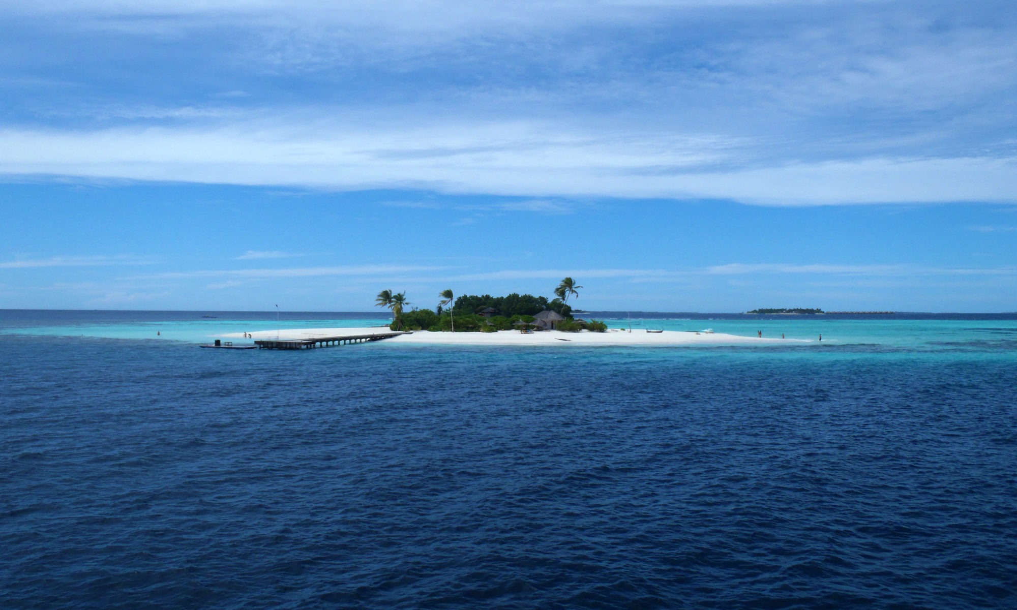
If you enjoy boating in unfamiliar waters as much as we do, you will quickly find that a GPS can be your best friend. Often times the recreational boater finds that reading compass headings and nautical charts are daunting tasks. With this in mind, we developed Florida By Water with one of the main goals as providing GPS coordinates for every location. This give you the ability to pinpoint the destination that you are trying to find. However, many of us quickly become confused with the new terminology such as waypoints, tracks, and routes. This article will provide you with a few of the basic skills need to navigate to your chosen location. Please note this is in no way a compressive document on the Nautical Navigation.

Basic Terms in Plain English
Waypoint: A waypoint is a specific location such as a restaurant, marina, or boat ramp. When you look at a location at Florida By Water you will find the GPS coordinates for that location. This will be a waypoint that can be added to your GPS. For example, if you were in Key Largo and wanted to snorkel at “Christ the Abyss” you would enter this waypoint into your GPS: 25.1242155, -80.2974027. Your numbers on your GPS may look different and we will explain those differences in a minute. Anyhow, to get to the location, simply enter the waypoint and follow the GPS map to that waypoint. One thing to keep in mind is that your GPS will take you there by a direct line, which in many cases, in not a very viable option.

Route: A route is a series of waypoints used to get you to a specific location. This allows you to go from one waypoint to the next until you reach your destination. This way, you can navigate around obstacles and shallow water. Creating a route on the GPS itself is possible but can become difficult if you have a smaller screen. At Florida By Water, we use route-planning software. This gives us the ability to take our time and create a route in the comfort of our homes on a computer rather than while out on the water and trying to navigate at the same time. Once the route is loaded into your GPS/Chartplotter you can simply select the route and follow it on your GPS screen. It works very similar to the GPS in your car. The difference is that your car GPS will create the best route for you, while the Chartplotter requires you to create the route. Most manufactures have routing software available for a small fee. Garmin has a program called Homeport. This will allow you to create waypoints and routes, and directly upload them to your GPS/Chartplotter unit. https://buy.garmin.com/shop/shop.do?pID=64242

Track: Think of a track as a digital recorder on your GPS. When you turn tracking “on”, the GPS will track the movement of your boat, display it on the unit for you to see, and save it for you. This can be extremely handy if you would like to see where you have been, or to follow the track back to your starting location. The tracks are shown as little black dotted lines on a Garmin unit and the tracks can be downloaded or turned into a route for future reference.

My Numbers Don’t Match!
One of the first show stoppers for new GPS users is finding GPS numbers and realizing they do not look like the numbers on their unit. For example, these sets of numbers all reference the same location:
25.1242155 -80.2974027 (Degrees)
N25°7.45293 W080°17.844162 (Deg° Min)
N25°7'27.176″ W80°17'50.65″ (Deg° Min' Sec”)

Depending on how your GPS is set up, it will use one of these formats. The good news is that it can be changed to use the format of your choice. The key is being able to convert one type of numbers to the other. This website is a great resource for converting the different formats: http://www.gpsvisualizer.com/calculators
Florida By Waters uses “Degrees” as the preferred format. It is also note worthy that you can change the preference in Google Earth to match your preferred format also.

So Many Options
The people at Florida By Water are GPS junkies. I personally have 6 of these handy little devices. With the exception of the iPhone, they are all Garmin. Not that I’m claiming that Garmin is any better than the others; it’s just a matter of familiarity with the interface. There are a few things to keep in mind when purchasing a GPS.
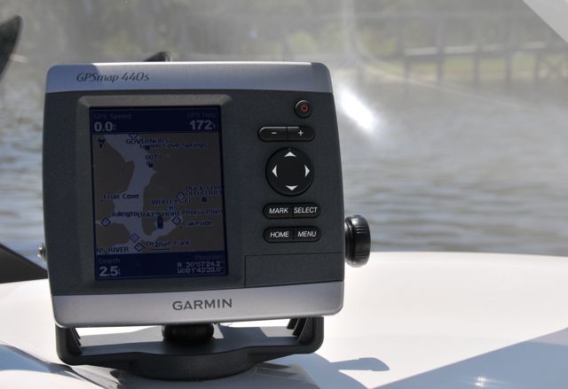
1. Make sure you get the one that fits your needs. GPS’s range in all shapes and sizes. Personally, I like to have to have one that has a 15” screen but that would be a little impractical on a 23’ bowrider. Thus I settled for the 440’s (the S means that it has a sounder or depth finder) this one has a 4’ screen and fits nicely on the boat.
2. Make sure that charts are preloaded. You will find that the price can vary between units. Many times this is due to features like weather, sounder, or preloaded maps. Note that preloaded maps may be costal or inland lakes. Theses maps provide you nautical charts that should include water depths as well hazards and other pertinent information. If your unit does not have the charts preloaded you will need to purchase them separately. Garmin sells charts for their units for around $100.00 per region. That can get expensive in a hurry. Another consideration is that purchased charts may give more detail than preloaded charts and the amount of detail and size of the region will affect the price.
3. Handheld devices can be a great choice. If you have a smaller boat or do not get out that often you may opt for a hand held unit. These can be great fun and have other uses as well such as Geocaching (http://www.geocaching.com/). Once again, it’s best to get one with charts preloaded.
4. We know and understand that the iPhone has a built in GPS as well as the ability to purchase nautical charts. However, if your iPhone is like mine, you really wouldn’t want to base your life or your boat on it. However as a backup, I wouldn’t be without it.

In Summary
• By a GPS/Charplotter with preloaded charts
• Purchase a Charting program that is compatible with your unit
• Go to the “preferences” section to set the desired degrees format (in the GPS and the Charting Program on your PC)
• Crete a few waypoints and routes on the PC
• Upload them to your GPS
• Enjoy the ride

As said in the beginning, this article is a very simplified overview to get you started. We always suggest reading your manual thoroughly in the beginning and then again after you have used the unit for a few months.

*Note: just because you have a GPS/Chartplotter does not mean that common sense goes out the window. Always use your eyes and be aware of your surroundings.

Helpful links and more information:
https://buy.garmin.com/shop/shop.do?cID=148
http://www.mrsps.org/gps_course.htm
http://www.gpsvisualizer.com/geocoding.html
http://sailing.about.com/od/navigationseamanship/a/basicchartplotter.htm